- April 18, 2024

-
-
Loading
Loading
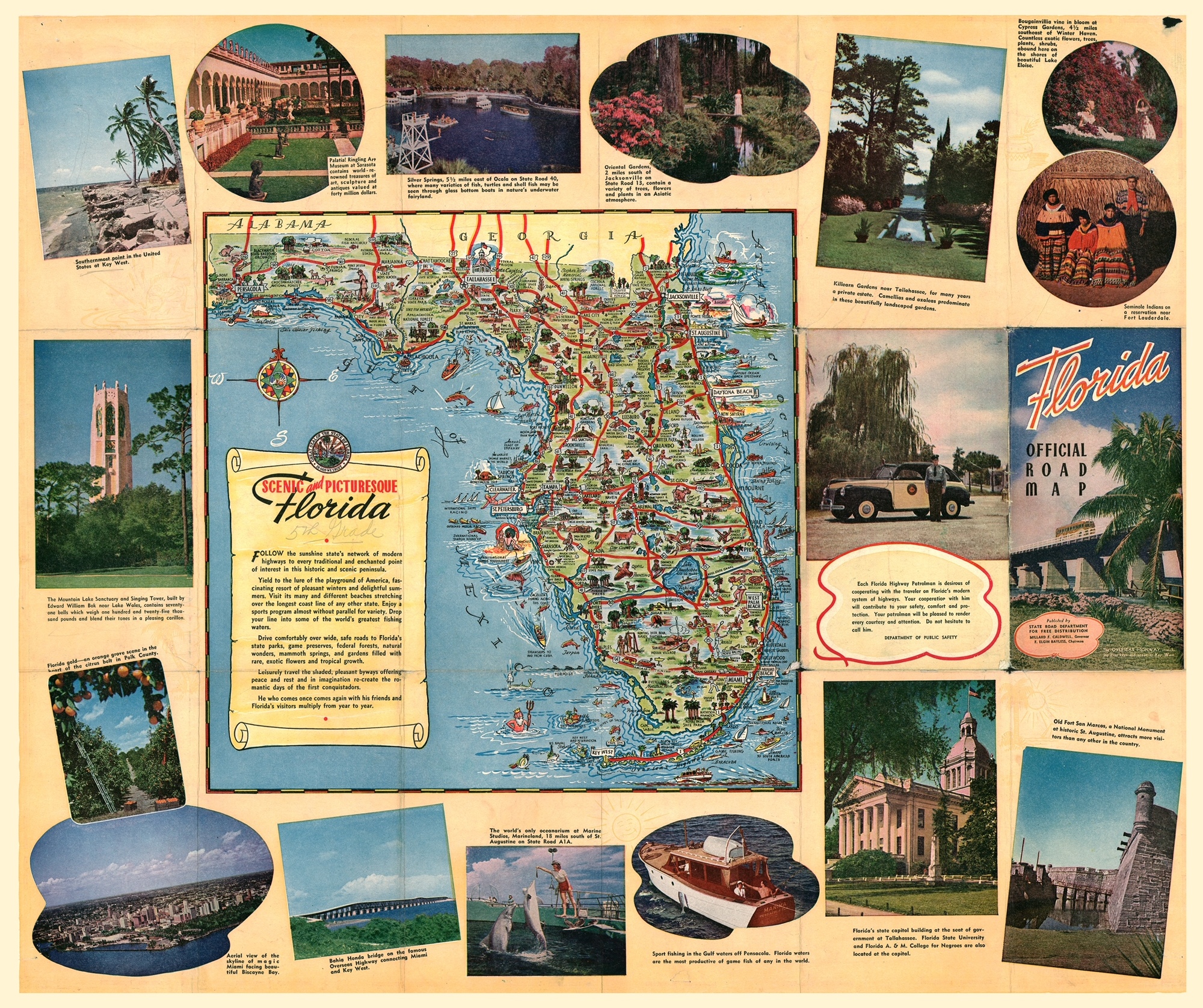
Locating a spot on a map nowadays is as easy as opening up your phone and clicking an app — but it wasn’t always this simple. In days gone by, the only option was a paper road map, which most folks usually folded up and kept conveniently in their car’s glove box.
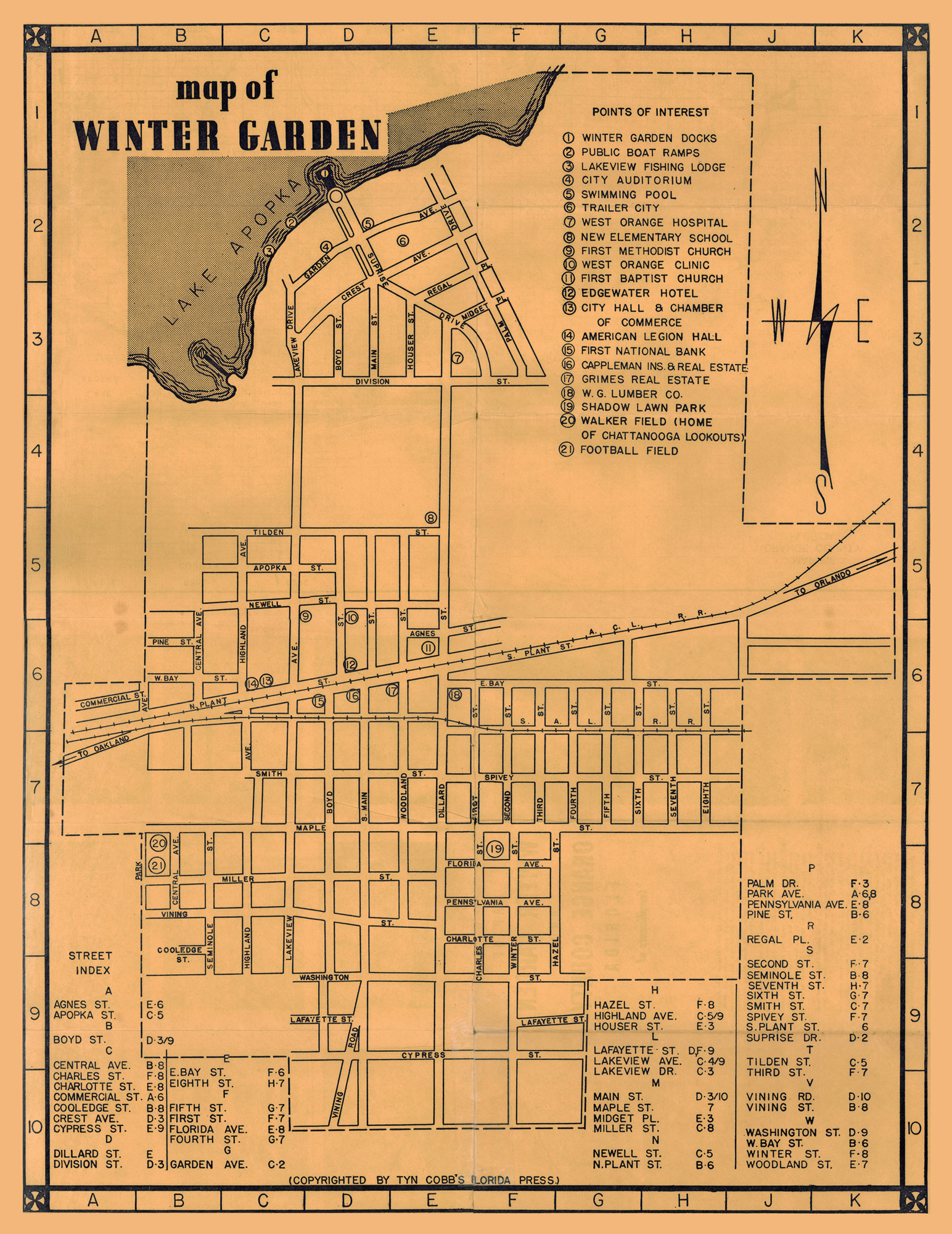
The Winter Garden Heritage Foundation is creating an exhibit that pays tribute to local mapmakers and their attention to detail in their products — which have guided residents, newcomers and vacationers along the streets for more than a century.
The exhibit, “Finding Your Way Home — There’s a Map for That! A Cartographic Survey of West Orange County,” showcases several dozen maps from the foundation’s archives, from the earliest rendition of the city of Winter Garden to a downtown map recently produced by the city.
Folks seem to have taken a real interest in local history, said Jim Crescitelli, director of operations and programming at the WGHF.
“With so many people moving to the area, we get a lot of people buying property here and they want to know the history of their property or subdivision,” he said. “People are very history oriented when they come to town and want to know the background. A lot of times we have a lot of maps that can locate what was there before. They really want to know the background of their choice of where to live.”
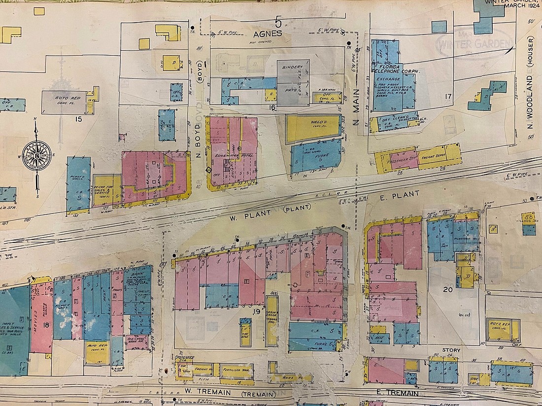
One of the more colorful maps is the Sanborn Water and Fire Map of Winter Garden from 1924, which was used by insurance companies. Small pieces of paper were pasted onto the map as businesses and residences were added or changed.
“Sometimes it was just a street addition,” Crescitelli said. “It was literally a pasted-on overlay.”
This practice continued until 1960.
The collection includes glossy scans of the 1917 and 1924 maps before any changes were made, so museum staff know what the original map looked like.
“We refer to that all the time to find out what was previously there on that property,” he said.
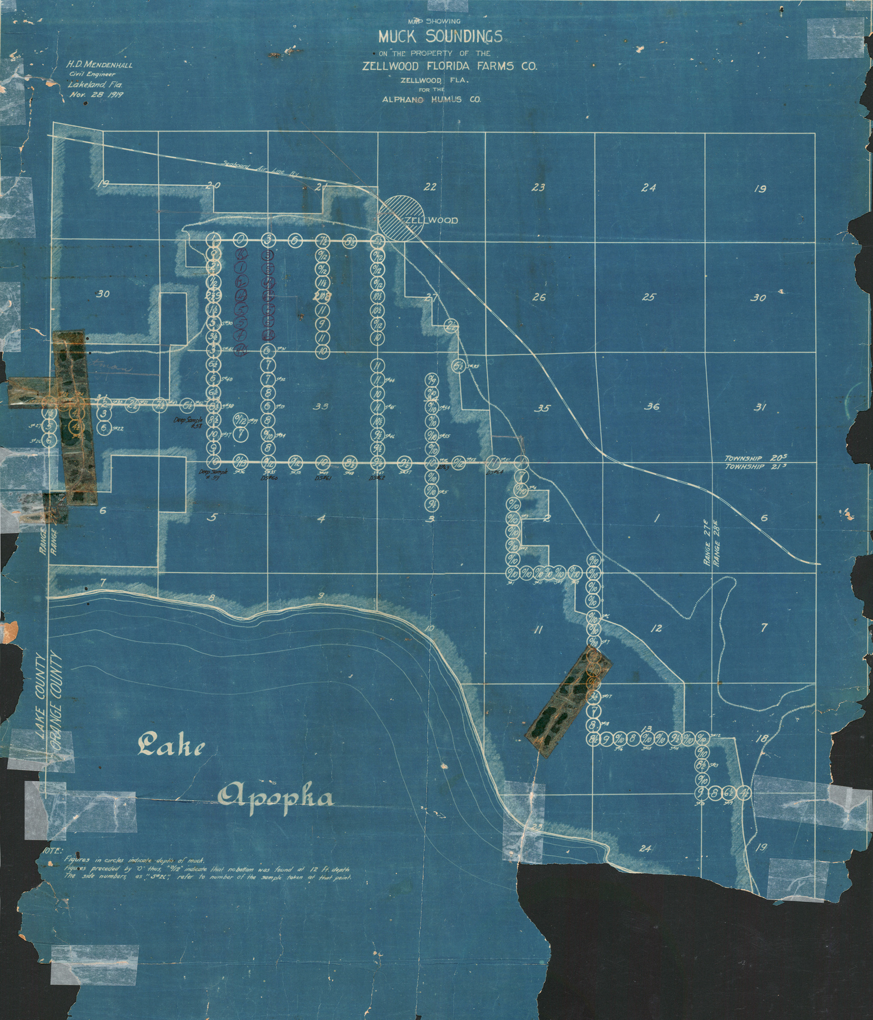
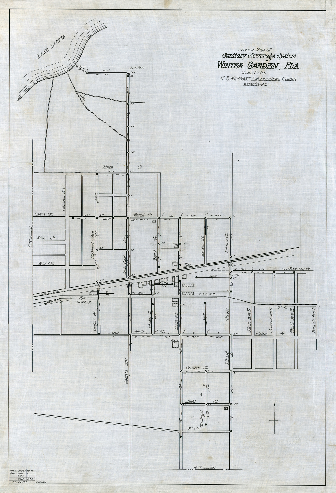
The museum has catalogued 279 maps and atlases, ranging from a 1923 sanitary sewer map, aerial photography maps and blueprints to plat maps and county and state maps. Many are donated from local residents, including Claude Hawthorne and Larry Grimes.
There are property plat maps, including neighborhoods, such as the Troynelle subdivision, that were developed northwest of downtown Winter Garden along Lake Apopka. The Winter Garden Shores subdivision plat map had handwritten notes all around it.
One of the oldest maps in the museum collection is a copy of the 1879 map of Orange County by E.R. Trafford. It includes Oakland and Starke Lake but not Winter Garden or Ocoee, and it shows all of the area’s former train stops.
An 1890 Fries survey map of Orange County shows all the small railroad communities that dotted their way across West Orange County too.
Sketch maps from 1904, 1907 and 1912 from the Orange County Comptroller’s Office — including those of downtown Winter Garden around the time of the city’s official incorporation — also are stored at the museum.
There are maps from every local municipality that was involved in the citrus industry, and there are maps from oil companies, chambers of commerce and state tourism agencies.
The foundation has original blueprints from the 1940s development of Lake Apopka’s North Shore, as well as the blueprints of many structures found in West Orange County.
Also in the collection is a reproduction of the town of Oakland’s 1896 map that was set up by the Orange Belt Railway.
“It’s an enormous collection,” Crescitelli said.