- December 19, 2025

-
-
Loading
Loading
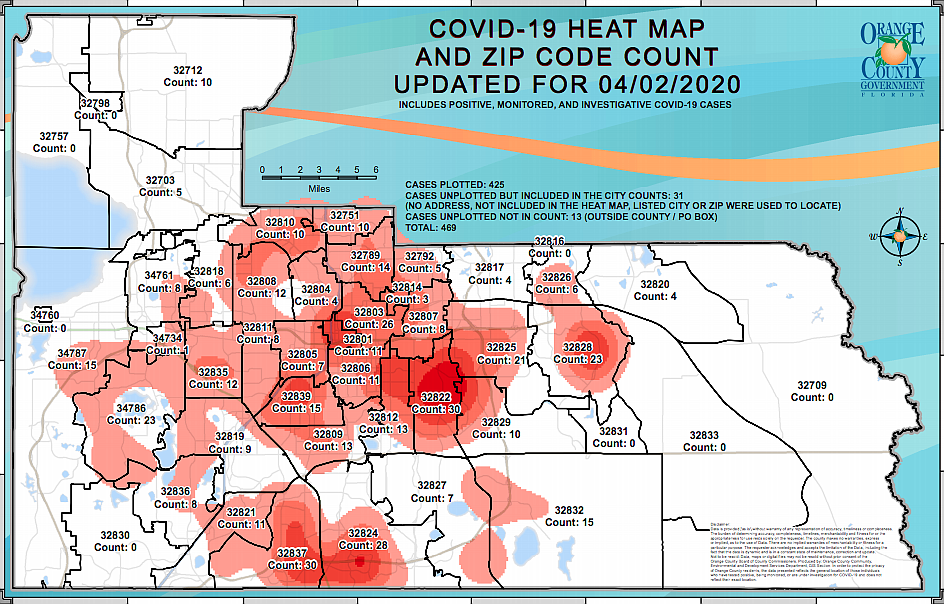
County staff has implemented a thermal map, updated daily, to give residents and visitors a visual as to where coronavirus cases are located.
The map is divided by ZIP codes and displays the thermal "hot spots," along with number of cases per ZIP code.
The latest version was updated April 2 and accounts for positive, monitored and investigative COVID-19 cases. It includes 425 plotted cases, 31 unplotted cases included in the city counts, and 13 unplotted cases not in count due to being outside city limits or having P.O. box addresses.
To view the latest version of Orange County's COVID-19 heat map and ZIP code count, visit the county's website or Facebook page.


