- May 7, 2026
-
-
Loading

Loading

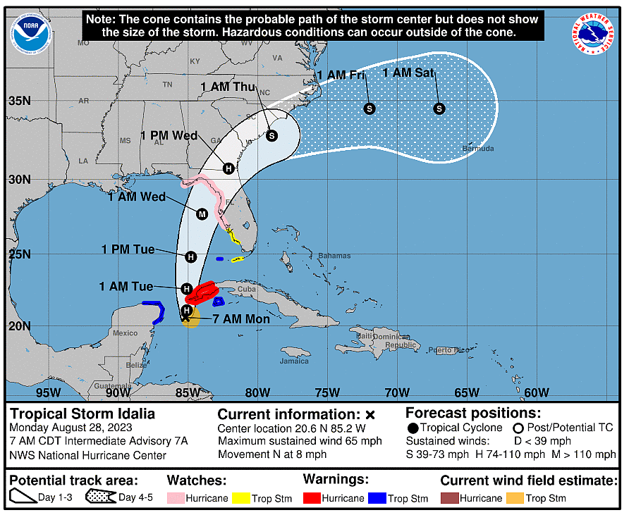
The St. Johns River Water Management District is monitoring closely Tropical Storm Idalia and is taking proactive measures to manage the anticipated winds and rainfall in the coming days.
Idalia continued to shift east overnight, putting the northern half of the District’s 18-county region in its path; and although the forecast indicates Idalia to be a Category 1 hurricane when it reaches the region, residents should be prepared to experience high winds and moderate rainfall.
The district is proactively preparing for the storm by taking the following actions:
• The district’s Emergency Operations Center has been activated to Level 2, which is a partial activation. This means the district will maintain direct communications with the state and affected county EOCs; ensure current storm information is distributed to all district staff; and direct the safe use of the district’s recreational facilities, such as campgrounds. As of Aug. 28, all public lands remain open for use. However, the district will continue to monitor the situation and anticipate announcing closures of some properties later this week depending on the storm’s path.
• This district is monitoring closely the storm’s path and water levels so it can provide information to the public and be prepared to assist local government partners and other regional and state agencies as needed. Once tropical force winds reach the district, all locks will be closed. Current forecasts have winds arriving Wednesday, Aug. 30.
Property owners should act now to be prepared for the storm by:
• Keeping debris out of storm drains and ditches;
• Reporting clogged ditches to local governments; and
• Cleaning out gutters and extending downspouts at least four feet from structures.
Visit the district’s website for information and links to flood statements and warnings, river stages, and local government emergency contacts.